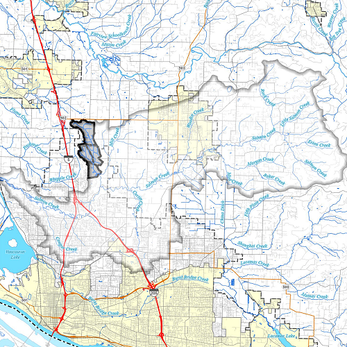
In December 2022, Clark County completed a stormwater study and tentative plan for a tributary to Mill Creek in the Salmon Creek watershed referred to as MIL2 tributary in past studies. The project meets a requirement under Clark County’s NPDES phase I stormwater permit issued by the Washington Department of Ecology in August 2019.
The report includes information on the study area, a description of ongoing activities to manage stormwater in the MIL2 catchment area, a six-year plan that may be considered for inclusion in the Stormwater Management Plan, and a twenty-year plan that may inform the Comprehensive Growth Management Plan. The plan’s main outcome is to recommend further, more detailed study of the stream to assess impacts due to increased stormwater runoff from planned urbanization and possible actions to protect the stream habitat.
The MIL2 catchment spans about 1400 acres or a little more than two square miles in southwest Clark County, Washington Nearly one square mile of the upper catchment rural land is inside the unincorporated Vancouver Urban Growth Area and slated for development in coming years.
The hydrologic analysis relied on hydrology models created using the WWHM-SWMM model of Clear Creek Solutions, Inc., and parameters from a HSPF model calibrated for the Mill Creek subwatershed by Otak, Inc. in 2010. The hydrologic modeling allowed Clark County to estimate the effects of planned land use on stream hydrology based on current zoning.
No water quality model was created based on results from an earlier study in the Whipple Creek watershed showing that the build-out scenario met water quality standards, except for bacteria, which are only possible to remove from stormwater runoff by using infiltration facilities.
With full implementation of detention basins under current code, the modeled results did not provide stream flow similar to the existing hydrology, with some increase in flows that may erode channels. This is due to soil and geology conditions that will likely make Low Impact Development (LID) infeasible under state and county standards.
Several stormwater management strategies and best management practices were considered for managing runoff from development. These strategies focused on limited infiltration from LID BMPs, allowing limited infiltration from stormwater ponds and increasing detention pond size by changing flow control standards.
