Public Notice map revision below
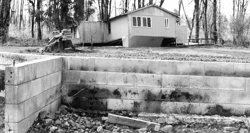
Home swept off its foundation during the February 1996 flood.
Revised flood insurance rate maps, along with a Flood Insurance Study for Clark County, took effect Sept. 5, 2012. Revised flood insurance rate maps that cover properties along the Washougal River, along the Little Washougal River and behind the Port of Camas-Washougal’s levee on the Columbia River took effect on Jan. 19, 2018.
Clark County adopted the maps, prepared by the Federal Emergency Management Agency, so county residents could continue to purchase flood insurance through the National Flood Insurance Program.
What the maps indicate
Flood insurance rate maps identify flood hazard zones in Clark County, including the “base flood” area that has a 1% chance of being inundated in any year.
The maps help community officials and local residents identify flood risks and are used for flood insurance, land use and development decisions.
You can determine the correct flood insurance rate map (FIRM) for your property using the FIRM index for Clark County.
Flood Insurance Rate Map Index (FIRM) (PDF)
You also can find the map for your property on the Federal Emergency Management Agency's Flood Map Service Center.
Flood Insurance Study
Residents also can review the Flood Insurance Study for Clark County, which covers the county and its incorporated cities. The study will be used to establish flood insurance rates and to assist local governments in promoting sound flood plain management.
PUBLIC NOTICE
Upcoming Map Revision - North Fork Lewis River
A revision to the floodplain of the North Fork Lewis River is forthcoming between River Mile (RM) 7.69 and RM 8.61, affecting FIRMs 53011C0061D and 53011C0062D in Clark County. Please click on the title for more information on the revision.
More Information
Michelle Dawson
Engineer III - Community Development
michelle.dawson@clark.wa.gov
564.397.4568
