As a requirement of the State of Washington NPDES Phase I Municipal Stormwater Permit (2013-2018), Clark County is required to create a watershed-scale stormwater plan. The plan's goal is to identify a stormwater management strategy(ies) that would result in hydrologic and water quality conditions that fully support 'existing uses' and 'designated uses' (per WAC 173-201A-602) throughout the stream system.
- Whipple Creek location
- Whipple Creek history
- Learn about
Watershed Assessment Plan Report
Clark County Whipple Creek Watershed-Scale Stormwater Plan Report (September 2017)
Clark County Whipple Creek Watershed-Scale Stormwater Plan Appendices (September 2017):
- Appendix A - Water Quality and Land Cover Relationship
- Appendix B - Assessment of Existing Water Quality Conditions
- Appendix C - Benthic Macroinvertebrates Summary
- Appendix D - Status of Whipple Creek Watershed Aquatic Community
- Appendix E - Whipple Creek Watershed Areas Appropriate for Special Attention
- Appendix F - Whipple Creek Watershed Hydrology Model Calibration Report
- Appendix G - Whipple Creek Watershed Water Quality Model Calibration Report
- Appendix H - Clark County Hydrologic Metrics Correlation to B-IBI
- Appendix I - Clark County Hydrologic Metrics as Designated Use Targets
- Appendix J - Whipple Creek Watershed Existing and Future Land Cover Data
- Appendix K - Using WWHM to Model Strategies for Full Build-Out Scenario Inside Whipple Creek UGA
- Appendix L - Channel Restoration Analysis
- Appendix M - Whipple Creek use Attainability Initial Discussion
- Appendix N - Clark County Stormwater Regulatory Background
- Appendix O - Whipple Creek Watershed-scale Stormwater Plan Report Cost Estimates
- Appendix P - Whipple Creek Watershed-scale Stormwater Plan Report Financial Analysis Technical Memorandum
- Appendix Q - Analysis of Watershed Prioritization for Stormwater Retrofits
- Appendix R - Whipple Creek Watershed-scale Stormwater Planning Scope of Work
Whipple Creek location
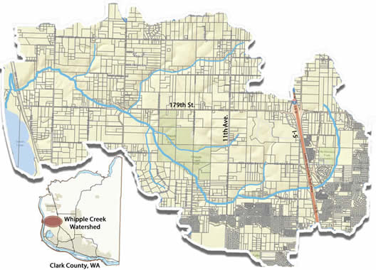
The Whipple Creek watershed is located in western Clark County, draining west from the low hills just east of I-5 (from approximately NE 144th St. to NE 194th St. and NE 29th Ave.) to the Lake River. The 12.1 square mile watershed is part of the West Slope main watershed that makes up NW Clark County. The upper sub-watershed is 8.8 square miles and includes approximately 4.4 square miles inside the Vancouver urban growth boundary. The lower sub-watershed is 3.3 square miles and is mostly rural. Below is the current 2014 map of the watershed:
Whipple Creek history
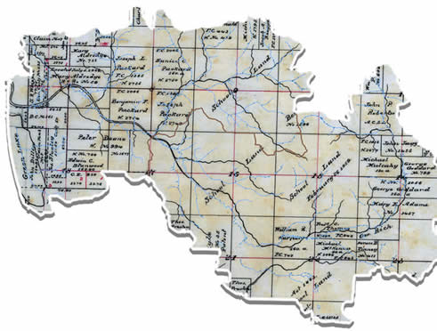
The Whipple Creek watershed was once dominated by rural and agricultural uses, as well as forested riparian corridors. Clearing has occurred overtime to make way for farming, agricultural uses, housing and commercial development. The image below shows the land holdings in the 1886 Donation Land Claim document for T3NR1W.
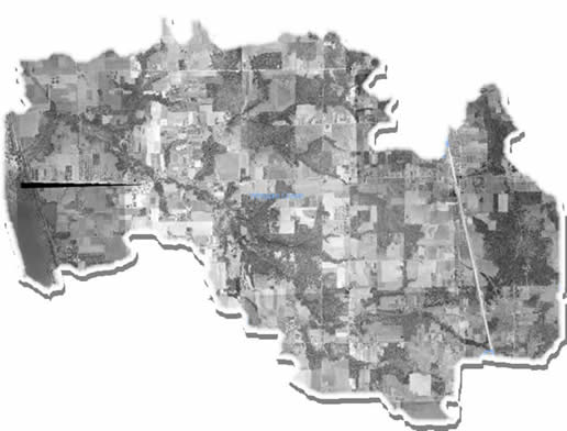
The 1955 aerial photograph shows the extent of forest cover as well as the agricultural farm properties throughout the watershed.


